Most watersheds aren't well-monitored. Most deadlines don't allow for a multi-year data collection effort. Lynker Spatial Hydrology delivers validated streamflow simulations at any location, across any time period, so your team can move forward with confidence, not caveats.
Built by expert hydrologists and Earth system scientists with applied experience in operational forecasting, watershed modeling, and large-sample hydrology across consulting, academic research, and federal agency support contexts.
NSE = Nash-Sutcliffe Efficiency. A score of 1.0 is perfect; below 0 means the model is worse than using the average. See the case study below for full context.
Rivers and streams are dynamic. They change across landscapes and through time, with responses from individual storm events to long-term hydroclimatic trends. To assess these systems accurately, you need simulations that capture that variability, not static approximations.
Streamflow gages cover a fraction of the river network. Permit decisions, flood assessments, and water supply analyses routinely rely on regional approximations, outdated baselines, or the National Water Model. None of these were designed for site-specific accuracy or ungaged watersheds.
Lynker Spatial Hydrology closes that gap. We apply large-sample hydrology methods to run validated simulations directly on the Lynker Spatial Hydrofabric, a connected representation of every catchment, flowpath, and junction across the US, to characterize streamflow at any location, even where no gage exists. Our models have been validated against decades of observations across thousands of catchments, including data-sparse regions where the uncertainty matters most.
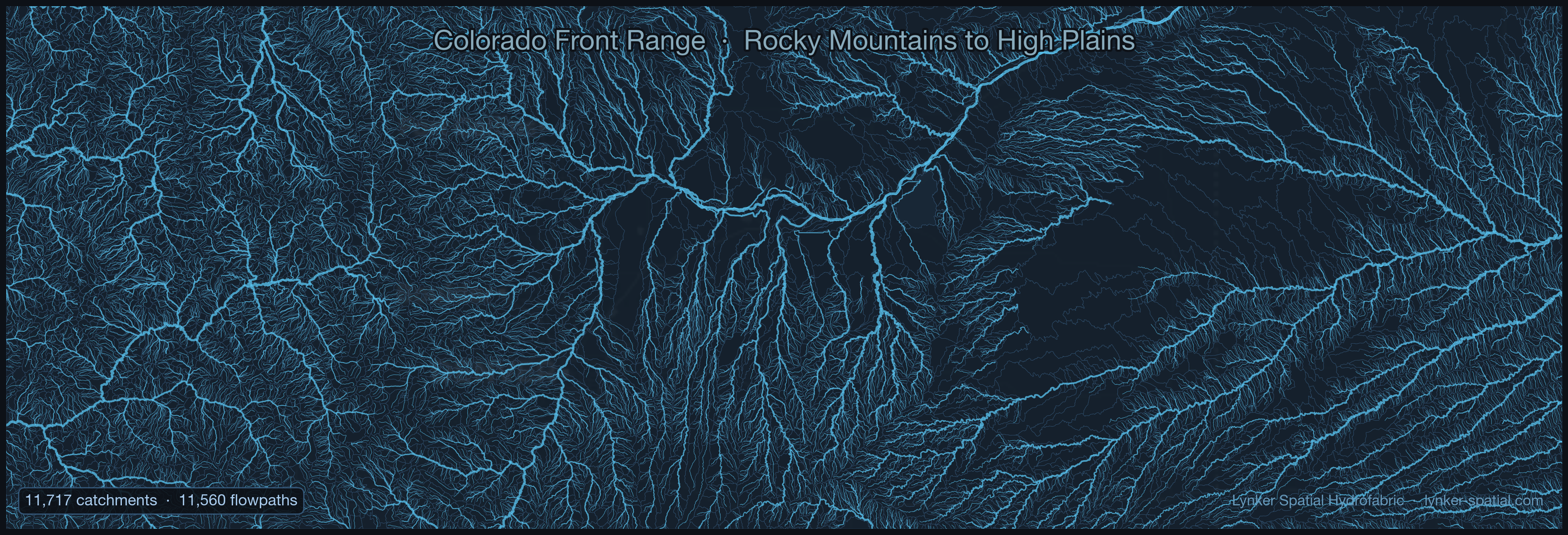
Simulations run directly on the Lynker Spatial Hydrofabric, which means water moves through a physically connected network, not a statistical approximation. Catchment response propagates downstream the way it does in the real world, from headwaters to major river corridors.
Different watersheds behave differently. Snowmelt-dominated basins in the Rockies don't respond like rain-fed catchments in the Southeast. Our model-agnostic framework spans data-driven and physics-informed approaches, including NOAA's Next Generation Water Resources Modeling Framework, and lets us match the method to the landscape rather than forcing every problem into a single model structure. The result is more accurate simulations, better-characterized uncertainty, and outputs calibrated to what your project actually needs.
What this looks like in practice: USGS 01138000, Connecticut River headwaters, Water Year 2020. We simulated daily streamflow across the full contributing catchment network through the spring freshet and compared our output against the observed gage record. The right panel shows prediction skill for this basin compared to the NOAA National Water Model on the same period, one example of the kind of improvement we see in snowmelt-dominated systems.
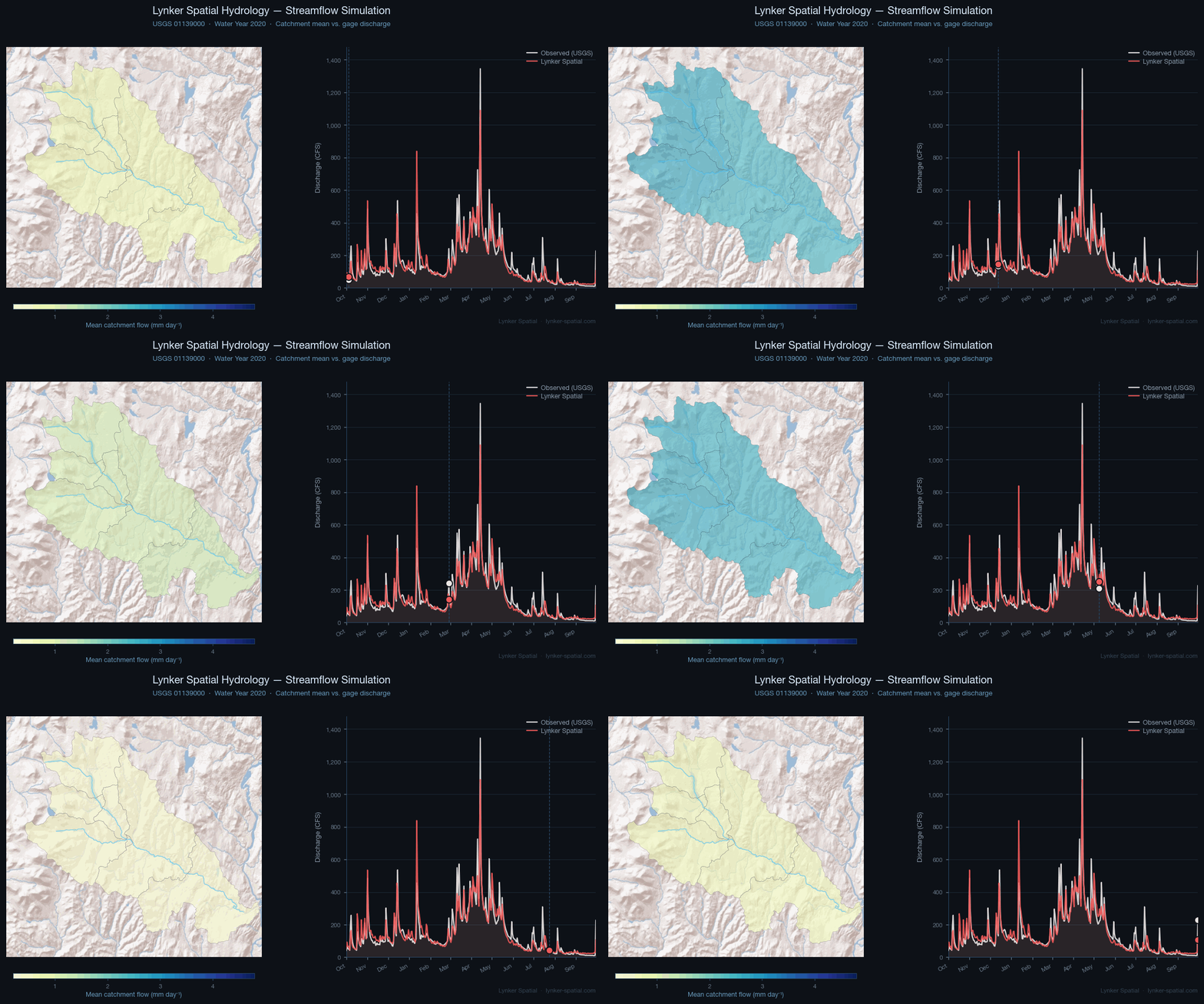
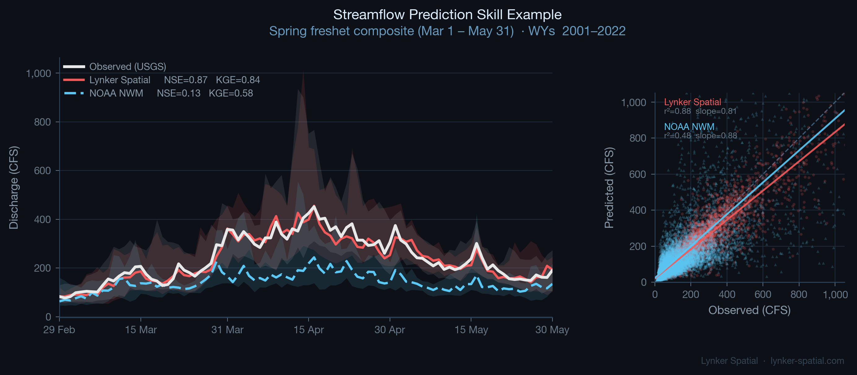
Spring freshet · Mar 1–May 31 · USGS 01138000 · Water Years 2001–2022. Single-basin example. Higher is better for both metrics; 1.0 is perfect.
Across federal agencies, state programs, environmental consulting firms, and research institutions.
The modeling described on this page can be operationalized through the infrastructure behind FlowFabric, Lynker Spatial's streamflow intelligence product. Where an assessment delivers a retrospective analysis for a specific project, FlowFabric provides the delivery layer: continuous, multi-model streamflow outputs as a data service, ready for dashboards, forecasting workflows, and decision systems that need hydrologic intelligence on an ongoing basis.
Most engagements start with a scoping call. You describe the watershed, the decision, and the timeline. We'll tell you what's feasible, what the outputs would look like, and what it would take. No proposal overhead required.